Poor soil quality and reduced crop productivity are just some of the many impacts of saltwater intrusion on Maryland’s Eastern Shore. To maintain the profitability and productivity of Maryland’s coastal areas, we must understand precisely what saltwater intrusion is and how best to respond to it.
When sea levels rise, salty seawater infiltrates the underground storage of freshwater. This process of encroachment is called saltwater intrusion. Saltwater intrusion is a naturally occurring process on coastal lands; however, the rise in global sea level is causing saltwater to infiltrate deeper into inland areas at an increasing rate. Saltwater intrusion is a significant cause for concern since this near-coastal land is not adapted for such a rapid introduction of foreign, salty (or saline) water into its groundwater table.
Coastal Maryland’s predominant crops of corn, wheat, and soybeans cannot reach their growth potential under saline conditions. Saltwater intrusion alters the chemical properties of nutrients essential for crop growth. Increased water salinity can draw out necessary freshwater from nearby native roots, change the pH level of the surrounding soil, and produce toxic chemicals that kill crop productivity.
The Hughes Center has responded to the needs of the land by focusing on understanding and remedying saltwater intrusion for all impacted communities. As of 2025, the Center has allocated almost $350,000 in research funding to saltwater intrusion research, producing 13 studies and counting, and has leveraged nearly half a million dollars in federal grant funding for a project with regional academic partners.
Background and Prior Studies
Saltwater intrusion as a pressing topic for the Center began with Dr. Kate Tully’s research at UMD’s Agroecology Lab. Tully’s mission was to view agriculture through a lens of ecology, leading her to discover a major root cause of many ag-related issues in the mid-Atlantic: saltwater intrusion. Her mission inspired the Hughes Center to provide funding to understand salinity changes in Maryland soils.
The studies that resulted from this initial grant testify to the Center’s dedication to collaboration as problem-solving. Top researchers from the University of Maryland, the University of Delaware, and George Washington University have come together to share data that informs policymakers and farmers alike on how saltwater intrusion affects Maryland’s ecology and agriculture, and what must be done to mitigate issues that stem from it.
Topics and methods of specific studies range from remote sensing detection of salt patches on farmland to economic assessments of increased salinity in soils to measuring nutrient concentrations in impacted coastal lands — all this for the long-term goal of identifying management strategies and recommendations for stakeholders to uphold ecologically and economically viable farmland.
Researchers have been working for years to uncover solutions to Maryland’s salty soils. Researchers are identifying specific nutrient-reducing crop varieties and developing new monitoring and regulation techniques. The Hughes Center is proud to be at the forefront of such a topical issue, hoping to support many more studies that delve into the effects and solutions to saltwater intrusion.
Ongoing Research
Drs. Kate Tully and Becky Epanchin-Niell of the University of Maryland are working to develop a public-facing tool to respond to saltwater encroachment. When saltwater enters soil, landowners must make quick land management decisions to minimize environmental impacts and economic losses. This study offers a tool, called Options for Adapting to Rising Seas (OARS), that will provide all the necessary information to aid decision-making. OARS will contain a database with relevant policies, programs, and organizations that assist with the impacts of saltwater intrusion. Each policy, program, and organization will be tested and verified against various conditions, ensuring the best possible response for a specific scenario.
Story Archive
Drone Imagery in Saltwater Intrusion Research

By Carrie Anderson
Hughes Center Intern, Summer 2022
Dr. Jarrod Miller spent last summer with his eyes in the sky, tracking drones as they flew up and down the fields of Dorchester and Somerset counties. An assistant professor and Extension specialist in agronomy at the University of Delaware, Miller is the lead drone pilot of a team working to track saltwater intrusion onto farmland along the Chesapeake Bay.
Miller worked as an agriculture extension agent in Somerset County before his work in drone imagery. He said that even in 2014, saltwater intrusion was on the radar of concerned farmers in the area. Around the same time, Miller teamed up with Dr. Kate Tully at the University of Maryland to seek funding for research on the complex issue. The two now work with colleagues at George Washington University on a project examining the extent of saltwater intrusion’s impact on the Lower Eastern Shore of Maryland.
Miller has to plan his excursions with care and consideration. Any condition that can change the drone imagery — for example, cumulus clouds — can create large shadows over fields, disrupting the sunshine reflection and skewing data collection. The night before fieldwork, Miller downloads maps with pre-selected points, as cell service in the fields can be unreliable. Because the drone is limited in battery life, ground control points are specified within the field where plant health and soil data collection occurs.
Recently, drones have been used more frequently in agricultural research. They can be inexpensive, easy to use and incredibly precise in imagery collection. The data provided is versatile and used for a number of different research projects.
The drone shows a simple yet detailed representation of the problem that cannot be seen at eye level. It can measure plant height precisely over whole fields, able to see past the green ground cover of crop canopy. While crops may seem healthy, the drone can reveal patterns of declining plant height which can indicate a salty or flooding field.
“The vantage point is much different from the ground, and everything becomes so clear immediately. Within 30 seconds out in the sky, you can see the bad part of a field,” Miller said.
For saltwater intrusion research, a drone can view a whole farm field within minutes and provide an apparent reason for a farmer’s poor yield. Reaching 400 feet in the air within five minutes, any damage from salt, flooding or other field stressors is unmistakable.
Despite the ease of use and control, Miller says he can spend hours setting up and operating a drone, and conditions may not be in his favor. Remote sensing data can fill in gaps where drones are limited in capturing certain aspects of field imagery. Dr. Pinki Mondal, a researcher at the University of Delaware, works with satellite data and imagery, another vital component of the project on which Miller is partnering, which is mapping salty soils.
“What was missing was taking it to a larger geographic scale because field data collection is very time-consuming and also expensive. You need a lot of people, a lot of time to get data. But, what I offer to this group, to this kind of work, is utilization of satellite data or remotely sensed data through which we actually sample a larger geography, a larger scale, without always visiting every farm,” Mondal said.
Researchers like Miller and Mondal show that drone and satellite imagery can gather pieces of the puzzle that other scientific sampling cannot. Paired with soil and plant sampling from the ground, the researchers have created the whole picture of patterned saltwater intrusion. The once tedious task of mapping miles of land has been digitized, and the pattern of saltwater intrusion can be established relatively easily.
“It gets us beyond one single farm. It shows us what’s happening and where. We’re right now working on perfecting this method, but once we have the method, you can go beyond the Delmarva,” Mondal said.
With drones in the sky, a long and difficult part of research is already completed. Saltwater intrusion is happening across the Mid-Atlantic, throughout the coastal United States and even globally. As mapping becomes accessible and manageable, it shapes how researchers respond to climate change and its varying effects.
Resist, Restore or Retreat
A Complex Dilemma Maryland Farmers Are Facing
By Chelsea Patterson
Hughes Center Intern, Summer 2022
Salt-induced land degradation threatens agricultural lands, contributing to global annual economic losses between $12 to $27.3 billion, mainly due to reduced crop yields. (Qadir et al., 2014) Farmers along the Eastern Shore of Maryland are increasingly burdened with the costs of managing fields with rising soil salinity – a direct effect of saltwater intrusion.
Saltwater intrusion is when saline, or salty, water encroaches inland. It is a natural process in coastal ecosystems. However, with rising sea levels, salty water is traveling further inland than ever before.
This is especially concerning for farmers, who may experience 15 to 69 percent revenue losses if no action is taken to address the high salinity levels in their crop fields (Qadir et al., 2014). However, for a long time, there has been limited research into management options and best practices that farmers can use to mitigate damages from saltwater intrusion, particularly in the Chesapeake Bay region.
So, with limited information, many farmers are facing a tough decision of whether to keep their land in agriculture – investing more time, money and resources into fighting increasing soil salinity – or taking their land out of agriculture altogether, reducing their overall yields and lowering profits.
Larry Beauchamp is a farmland manager in Somerset County and has been undergoing efforts to restore an abandoned plot of land into a farmable crop field once again. “I’ve been trying a little bit of everything trying to get (crops) to grow there…but I’m not having a whole lot of luck,” he said.
Beauchamp has been trying potential solutions of his own. He tried cleaning out a nearby tidal ditch and installing piping to pump out water whenever the field flooded. However, he said that this made little difference because whenever high tides came, the pipes allowed water to flood the field faster than before, creating a no-win situation.
“It's unbelievable how much of a difference there is,” said Mr. Beauchamp. “There was a big difference 30 years ago, but now it just seems like it's accelerating and I don't know what the answer is.”
With input costs increasing and diminishing profit margins, other farmers have decided to take their land out of agriculture, choosing to restore their land – including converting it into a wetland or hunting ground – or abandoning it entirely.
“The next option is adaptation. So, that could mean planting a transitional crop…or it could mean restoring the land,” said Dr. Kate Tully, a scientist and head of the Agroecology Lab at the University of Maryland. “The third option is retreat or abandonment, which is when someone may abandon their house or land, doesn’t put any more investment into it, and just lets it go.”
Whether they decide to keep their land in agriculture or take it out, the takeaway sentiment is that farmers are looking for guidance from researchers on how to handle their salt-impacted fields.
The Harry R. Hughes Center for Agro-Ecology (Hughes Center) is partnered with a team of researchers at UMD Agroecology Lab, the University of Delaware (UD), and George Washington University (GWU) that is collecting data on plant and soil health in salt-impacted crop fields to develop best management strategies for farmers and landowners. As part of their research, the team identifies plants best suitable for high soil salinity levels, maps the current extent of saltwater intrusion, and develops predictive modeling to track its future reach. The team is gathering data from salt-impacted farmlands in Somerset and Dorchester counties, where saltwater intrusion has been a growing concern.
Dr. Pinki Mondal, Assistant Professor of Geospatial Data Science at the University of Delaware and the head of the Earth Observation for Sustainable Ecosystem & Livelihood (EASEL) group, said, “If our team can find a relationship between plant data and satellite data, then we can…train our model to take new satellite data and predict (saltwater intrusion) over larger regions.”
Similar to sea-level rise models, predictive models for saltwater intrusion could serve as a vital resource and guide decision-making. This mapping would provide a general timeline of the extent and intensity of saltwater intrusion on farmlands, which, combined with additional research on salt-tolerant crops and restoration options, can help farmers and landowners make more well-informed decisions about the future of their land.
Salty Conditions in Eastern Shore Crops
What does saltwater intrusion do to soil and how does it impact crops?
By Carrie Anderson
Hughes Center Intern, Summer 2022
Soil is perhaps the most important factor in crop health, aiding nutrient and water transport, and supplying oxygen and natural filtration of pollutants for plants. In Maryland and along the Eastern Shore, favorable ratios of sand, silt and clay combine with a temperate climate to create fertile silt loam hosting an array of crops.
These plants also affect the soil's health, supplying organic matter, preventing erosion and aiding nutrient cycling. Rotating crops and no-till farming can support higher crop yields. Deep-rooted cover crops can also help by conserving necessary soil qualities and improving drainage.
For years, Dr. Kate Tully, an associate professor of Agro-Ecology at the University of Maryland, and fellow scientists have examined how salt behaves in agroecosystems. Over three different test sites in Somerset County, despite diverse soil and land use, Tully's research shows overwhelmingly similar biogeochemical responses to intruding salt (Tully, 2019).
When saltwater intrudes on agroecosystems, the soil is the first to feel its effects. Chemical properties of nutrients may be altered, specifically ionic strength, alkalization and sulfidation. The increase in ionic strength of the saltwater creates osmotic stress in plants not adapted for salty soils, drawing freshwater out of native trees and grasses along with crops (Tully, 2019). This change in ionic strength may also increase ion exchange in nitrogen and phosphorus, possibly displacing the nutrients necessary for crop health.
Alkalization, the rise in soil pH, occurs when sodium interacts with clay particle dispersion, resulting in plugged soil pores, affecting water interactions between plants and soils. Alkaline saltwater also activates bonds between cations and dissolved organic matter, which may induce carbon sequestration and burial.
The introduction of sulfur occurs when saltwater intrusion is chronic and can lead to changes in ecosystem carbon storage. Although frequent flooding doesn't happen across whole farm fields often, the hydrogen sulfide produced by the interactions is toxic to plants and drives shifts in plant productivity.
With so many factors changing plant and soil interactions and predictions that saltwater intrusion will increase along the Bay's edges with sea level rise, research continues to understand the future of saltwater intrusion into agriculture.
A master's student at George Washington University's Gedan Lab, Caitlin DiCara is one scientist looking for answers. DiCara explains that high salinity in non-saline plants can be comparable to drought conditions, describing indicators such as discolored leaves, reduced biomass and dry cracks in soils.
"If the soil is too salty and the water trying to be absorbed in plants is too salty, it will actually create an osmotic gradient that stresses your water conditions. Even though you have water available, it's not accessible to plants," DiCara said.
Corn crops have a salt tolerance almost 10 times lower than the level of salt that was measured in ditches along farm field margins (Tully, Weissman et al., 2019). Not all landowners are experiencing this phenomenon, but those that do often look to conservation and easement organizations to help transition land into restoration. At the Eastern Shore Land Conservancy, conservationist Larisa Prezioso sees landowners with low-lying, flooding and salty conditions where farming the land is no longer viable.
"We work with farmers in Dorchester County and they have some saltwater intrusion, and we're able to convert some of their agricultural land into an extended buffer with grasses instead of crops like soy," Prezioso said. "I've found that it's usually either nature decides for them, that they can no longer grow the crops and they'll convert it into something that's better use of that space, or I've found a lot of landowners just willing to give up acreages to various ecological initiatives.
The “Poster Duck” of Restoration
How does a saltwater intrusion project on the Eastern Shore relate to the American Black Duck?
By Carrie Anderson
Hughes Center Intern, Summer 2022
When winter migration season begins, along the shores of the Chesapeake Bay, communities look forward to seeing the American Black Duck, a beloved local waterfowl. Any website about the Bay will contain a feature on the bird, its habits and likes and dislikes. Its importance to the area also takes the form of a number of restoration projects, and the species has recently become the "poster duck" for Chesapeake Bay health and marsh restoration.
The American Black Duck, a close relative of the mallard, is what biologist Ed Farley calls an "Atlantic flyway special." Ranging from North Carolina to Canada, the black duck is a year-round frequenter of the Chesapeake Bay and some of its tributaries. The black duck is particularly fond of Maryland's Eastern Shore, creating habitat in secluded brackish and tidal wetlands.
Farley, a regional biologist for Ducks Unlimited, describes the black duck as "dabbling not diving," a species that relies on 6- to 10-inch shallow brackish and freshwaters for feeding and activity. High and stable salt marsh plants are used for nesting along the Chesapeake Bay, mostly in winter but year-round as well.
According to the Chesapeake Bay Program, wintering black duck populations are 10.4% of what they used to be in the region. While wetland habitat loss was likely a significant driver of this previous decline, the low numbers can also be attributed to the black ducks' particular needs compared to the Mallard. The quiet tidal marsh and sheltered forests preferred by the black duck are hard to come by, making habitat a difficult find.
After previous years of great decline, the black duck population levels have stabilized. However, these numbers are still far below long-term goals for the species. Farley says that future habitat loss is a big point of concern contributing to further decline.
Farley and Ducks Unlimited works to conserve and restore wetland ecosystems across the country, primarily to create stable waterfowl habitats. They partner with other organizations and secure funding for wetland restoration projects. One partner, the Eastern Shore Land Conservancy (ESLC), works in Dorchester County with Ducks Unlimited conserving natural resources.
Larisa Prezioso is a conservation specialist for ESLC and explains that ESLC will protect and monitor land use while organizations like Ducks Unlimited fulfill the actual restoration. In Dorchester County, Prezioso says saltwater intrusion is one major reason farmers choose land easements with ESLC, and Farley backs this reasoning up.
"We've definitely seen how (saltwater intrusion) can hinder agricultural activity and also result in marsh loss, so it's a big issue in this area," Farley said. Other climate change-related problems like increased flooding from king tides also create needs for restoration.
"We work with landowners and farmers and say, 'Where are you having limited agricultural productivity because of water? Where are the wet areas in your fields?' This is just one way we can help address water quality issues while providing some habitat on the ground for waterfowl," Farley said.
This work benefits agriculture, native species and the health of the Bay, connecting ecosystems and creating resilient communities. Dr. Kate Tully, an associate professor of Agro-Ecology at the University of Maryland, is one of the lead scientists on another project working on creating this same resiliency.
Through the National Fish and Wildlife Foundation's Small Watershed (NFWF) grant, the Harry R. Hughes Center for Agro-Ecology is helping to fund Tully’s research that aims to benefit the black duck. Researchers are identifying land at risk of future saltwater intrusion and possible areas that would benefit from tidal marsh creation. Native grasses, soil salinity and water quality are studied along saltwater intruded farm fields in the hopes that farm field margins will be viable options for restoration work.
Tully says this NFWF grant will focus on implementing native marsh communities, increasing the quality and quantity of land along the Bay's shores. It is hoped that this, in turn, results in a number of benefits for the area.
"People are rallying behind the black duck," Tully said, "and if you're saving the black duck habitat, you end up saving habitat for thousands more species."
The black duck represents the ecological prosperity that follows when marshes are restored. Strong funding and grants behind the black duck have conservationists and scientists like Farley, Prezioso and Tully excited about working on the Delmarva.
"Resilience means that farmers, foresters and fishermen will have natural resources available to them to keep a viable natural resource economy in the future," Prezioso said. "Ecologically, it means there's a good number of diverse species that benefit the landscape and the landscape benefits them. Together all of those pieces provide good habitats for species flourishing.
Predicting Saltwater Intrusion from Space
By Chelsea Patterson
Hughes Center Intern, Summer 2022
A pressing issue that Eastern Shore of Maryland residents are facing is sea level rise and the resulting impact of saltwater intrusion, or the underground inland encroachment of saline water. But what if we could predict this intrusion of saltwater from space?
"When sea level rises, it puts more pressure on the underground freshwater storage," said Manan Sarupria, a Ph.D. student at the University of Delaware (UD). "And, when agricultural farmlands are located next to coastlines, they are very close to these groundwater systems. So, if that groundwater system gets polluted, the roots of the plants on coastal agricultural lands will take up the salty water."
Heightened salinity in the groundwater then has detrimental effects on crop yields.
"Saltwater intrusion changes the soil chemistry, which can have an effect on what's growing in a certain area," said Matt Walter, Ph.D. candidate at UD. "So, for the case of the farms we were on, a lot of crops are not going to be able to grow in those salty conditions."
Sarupria and Walter are part of the Earth Observation for Sustainable Ecosystem & Livelihood (EASEL), which is led by Dr. Pinki Mondal, who is also an Assistant Professor of Geospatial Data Science at the University of Delaware. They use remote sensing to detect salt patches on agricultural fields in Somerset and Dorchester counties to identify patterns in the severity and location of saltwater intrusion.
Remote sensing is the process of detecting and monitoring the physical characteristics of an area by measuring its reflected and emitted radiation at a distance, according to the U.S. Geological Survey. Sensors on satellites or drones have greater capabilities than the human eye, with the ability to capture near-infrared rays, ultraviolet bands, x-rays, and thermal bands, giving researchers a lot more information.
"For example, if you have two plants in front of you, both may look completely identical with your naked eyes so you can't tell which one is healthy and which one is unhealthy," Sarupria says. "But, if you view them with a near-infrared filter, you can detect which one is brighter and which one is duller…which can show you how healthy and nourished a plant actually is."
Their work is part of a collaborative team, including experts from George Washington University (GWU), the University of Maryland (UMD), and UD engaging with staff from the Harry R. Hughes Center for Agro-Ecology (Hughes Center). This team has been conducting research relating to saltwater intrusion for almost a decade now and is currently working to determine management options for farmers at-risk of saltwater intrusion and those already suffering.
The remote sensing work at UD is valuable for the team because it maps the current extent of saltwater intrusion, and it can be used to train a machine-learning algorithm to assess the new satellite data for salt patches automatically.
In 2019, Walter helped pioneer this mapping of salt patches on cropland across the Delmarva region with Dr. Mondal. He primarily used 1x1 meter drone imagery from the U.S. Geological Survey's National Agricultural Imagery Program (NAIP), which is very high resolution but is only available every couple of years and is time-consuming to process. Walter also worked with imagery from Sentinel-1 and the U.S. National Aeronautics and Space Administration's Landsat program, highlighting the importance of using remote sensing data to assess the health of local wetland ecosystems.
Based on those initial findings, Sarupria is now conducting further research identifying these farmland salt patches using 10 x 10-meter resolution geospatial imagery from the Sentinel mission. The spatial resolution is relatively coarse for detecting salt patches, but it is available more frequently than previous imagery systems. By compromising spatial resolution, Sarupria gains more frequent estimations of salt patches throughout an agricultural season.
A benefit of using remote sensing is an archive of previous satellite and drone imagery beginning at the program's start. For example, the Sentinel program that Sarupria, Walter, and Dr. Mondal utilize started in 2014 and revisits the same spots every five days. So, even though this mapping project began in 2019, the team can look into the past to see how salt-impacted land has changed over time.
"The advantage of remote sensing is that you can really go back in time. As humans, even if you want to, you cannot go back in time, but satellite data does. So, we are able to use that information to understand how our environment is changing over space and time," Dr. Mondal said.
The UD team's efforts to develop maps identifying at-risk, salt-impacted land has broad applications.
"With this data, we can see how much saltwater intrusion is happening and where," Walter said. "The mapping would provide justification for actions taken by policymakers or landowners against saltwater intrusion, whether that's working on prevention or mitigation."
In addition to helping policymakers and landowners with their decision-making, scientists can use this research and maps created with remote sensing to help them better understand other saltwater intrusion patterns.
Sarupria hopes to use these maps soon to explain the appearance and disappearance of the salt patches on agricultural fields by analyzing additional hydrological factors.
By using remote sensing and gathering this information from space, scientists can continue to understand more about the complex problem of saltwater intrusion and develop mapping systems that can detect and predict the extent of saltwater intrusion in the future.
Back to the Future: How Research on the Past, Present and Future Extent of Saltwater Intrusion will Inform Policy Decisions
By Chelsea Patterson
Hughes Center Intern, Summer 2022
Throughout history, the United States responded to disasters with policy to help prevent them from ever happening again — like how the Cuyahoga River fires of the 1960s spurred water pollution controls through the Clean Water Act or when the Dust Bowl prompted the creation of the Soil Conservation Service (now the Natural Resources Conservation Service).
While responding to these disasters as they occur is important, policies must be proactive to prevent these environmental catastrophes from happening in the first place. But, lawmakers cannot predict the future, so how can they make effective decisions?
To make effective proactive decisions, lawmakers rely on science. One particularly concerning environmental problem that Maryland is facing is saltwater intrusion. As the sea level rises, waters engulf more and more land. Salty coastal groundwater mimics this movement, except it reaches even further inland. While higher tides and inundated land is fairly visible from the surface, saltwater intrusion encroaches below the surface, leaving ghost forests and cracked, salt-riddled fields in its wake.
Since saltwater intrusion is widespread across the Delmarva Peninsula, it is difficult to pinpoint its full extent so that lawmakers can implement strategies to mitigate its damages. And, once farmland experiences years of high-salinity soils and lower crop yields, farmers and landowners are left searching for alternatives.
Science and Saltwater Intrusion Policy
A team of scientists with diverse disciplines is working to help these farmers and landowners better understand their options, and provide lawmakers with the information they need to best support their constituents.
The National Fish and Wildlife Foundation (NFWF) granted funding to a partnership including the Harry R. Hughes Center for Agro-Ecology and scientists from the University of Delaware (UD), George Washington University (GWU) and the University of Maryland (UMD). The researchers have been collecting data on plant and soil health in salt-impacted crop fields, identifying alternative crops best suitable for high soil salinity levels, determining perennial wetland grasses that are resilient to weed pressures on old agricultural fields, mapping the current extent of saltwater intrusion, and developing predictive modeling to track its future reach.
“This research funded by the NFWF grant is looking at native plant species to see if…they can offer some environmentally-beneficial alternatives that landowners or farmers can use to provide ecosystem services rather than just letting the land go,” said Dr. Kate Everts, executive director of the Hughes Center.
The NFWF research will also likely be instrumental in helping to meet the goals outlined in the Maryland Department of Planning’s report, Maryland’s Plan to Adapt to Saltwater Intrusion and Salinization, released in 2019, which emphasizes the need for more research and information about saltwater intrusion. The current research may help lawmakers address some scientific needs, including updated data on available areas for migration of coastal wetlands and forests, locations of other factors (e.g., ditch networks) that impact resources, adaptation measures or other actions being taken by landowners, and the effectiveness and outcomes of particular adaptation measures.
Additionally, Maryland’s Phase III Watershed Implementation Plan (WIP) will benefit from new research. The purpose of Maryland’s Phase III WIP is to identify strategies, opportunities and challenges to meet 2025 Chesapeake Bay restoration targets and sustain restoration into the future. One of the challenges identified was saltwater intrusion.
Maryland’s Phase III WIP expressed a need to investigate the impact of saltwater intrusion on soil composition and the potential for nutrient leaching from soils, as well as investigate adaptation options – like salt-tolerant plants that take up nutrients.
By investigating these questions and better understanding saltwater intrusion and its processes, scientists can provide more clarity and guidance to lawmakers, which helps them form successful, supportive policies.
“As a decisionmaker, whether you are Maryland Department of Planning, a landowner or a farmer, having more information about what to expect and when allows you to anticipate those changes and then better make decisions that are then going to help you meet your goals,” says Dr. Becky Epanchin-Niell, an agricultural economist at UMD.
The Power of Science-Based Programs
Maryland has already felt the benefits of science-based policies with the success of programs like the Maryland Cover Crop Program.
Maryland’s Cover Crop Program was originally established to increase water quality in the Chesapeake Bay Watershed, and, through its efforts, discovered that cover crops also improve soil health. The program has yielded great success over the past decade, with over 478,000 acres of cover crops planted that prevented an estimated 2.9 million pounds of nitrogen and 95,600 pounds of phosphorus from impacting waterways in 2014 alone – serving as an example for states across the country.
One of the primary factors in the program’s success over time is its continued value and use of science.
As recently as 2019, the Harry R. Hughes Center for Agro-Ecology (Hughes Center) funded a project that explored the benefits of planting multiple species of cover crops in a single field rather than the typical monocrops and found that those multi-species fields contained more organic matter and available nitrogen, which could reduce fertilizer costs for farmers.
Based on the results of this project, the Maryland Cover Crop Program now includes multi-species cover crops, and the Maryland Department of Agriculture, which administers the program, has increased the reimbursement rate of multi-species cover crops to $15 per acre.
Moving forward, research must continue on environmental issues like saltwater intrusion, which has a complexity that can have devastating impacts if not appropriately addressed. As research continues and we learn new information about its impacts and risks — including the costs of inaction — lawmakers should reassess priorities and strategies for management.
Embarking on a Saltwater Trail: For years, researchers have made progress through scientific discovery and stakeholder outreach
By Carrie Anderson
Hughes Center Intern, Summer 2022
A long, complex history dating back to the very first agricultural fields on the Eastern Shore can show the inter-tangled story of saltwater’s far-reaching effects. Scientists have stationed their research along the Chesapeake Bay to understand climate and land transformations, looking for clues to help mitigate the impacts.
In 2014, Dr. Kate Tully of the University of Maryland (UMD) met Dr. Keryn Gedan of the George Washington University (GWU), who at the time was researching extensive ghost forests along the Bay and in Blackwater Wildlife Refuge with UMD. One afternoon, Gedan spent time over coffee illustrating to Tully just how far the problem reached, when Tully zooms out on the maps to get a better look at large white rings on the outside of farm fields.
When Gedan and Tully went out to Somerset County to get a closer look, the Somerset Soil Conservation District knew of the problem and was ready to show a number of fields facing the strange phenomenon. Driving by acres of bleached trees, deserted corn fields and Phragmites australis, an 8-foot tall invasive reed species displayed the extent of the issue, as well as proved salt as the culprit.
At UMD, Tully’s Agroecology Lab looks to find interconnectivity between agriculture and ecosystem services through different means. Viewing agriculture through the lens of ecology can increase desirable ecosystem services like improving water quality, soil health and adapting to climate change. To see that agriculture systems can be more than food and feed provisioners, and when managed properly, can provide benefits for the environment and people. This vision led to initial seed funding from UMD and the Harry R. Hughes Center for Agro-Ecology to gather basic data and investigate saltwater intrusion.
Since then, researchers have gone on to receive major grants, including from the USDA National Institute of Food and Agriculture. The 2018 grant aimed at preparing coastal farmlands for a future of saltwater intrusion and nutrient loss while developing adaptation methods for agroecosystems to create resilient environments.
Using methods on three test farms and one control, scientists considered how saltwater intrusion impacted crop productivity, soil health and agriculture profits. Methods included planting experimental salt-tolerant crops on site, helping to match productive planting to future farmland use, along with mapping tools to mark the spatial extent of saltwater intrusion.
An Extension portfolio was written to convey research outcomes to stakeholders throughout the region. While seeing saltwater intrusion at the source, Extension educators provide information for regional meetings and programs improving a farmer’s toolset against salt stress. Updated factsheets, story maps and a slew of scientific research papers also help researchers grow an informed base of stakeholders ready to adapt to the continuing challenges.
Through a current Small Watershed Grant from the National Fish and Wildlife Foundation, Tully and colleagues at UMD, GWU and the University of Delaware now look toward restoration-based solutions in the face of saltwater intrusion. By turning to restorative efforts, farmers have options and alternatives that fit the needs of the land and the surrounding ecosystem. Specific goals of the ongoing project include tidal habitat restoration creation on 32 acres of encroached land. By identifying critical areas and informing landowners about restoration practices, this grant offers an environmentally sound solution to saltwater intrusion with a goal of preserving agricultural productivity. This project includes efforts to provide outreach to stakeholders impacted by saltwater intrusion in collaboration with the Hughes Center for Agro-Ecology.
Scientists aim to apply current and past observations to future research and link these findings to other issues agroecosystems face. Farms face a composite of varying issues year to year that can change the way land is used. Increased frequent flooding, for example, can be detrimental to cropland over time, and can increase saltwater inundation, creating two problems in one field. Scientists understand this interrelation of issues, and work to provide multi-faceted solutions to keep land functional and adapt to these drivers of damage.
Mapping Saltwater Intrusion on Maryland’s Eastern Shore
By Carrie Anderson and Chelsea Patterson
Hughes Center Interns, Summer 2022
An invisible tide is actively threatening the future of farms along the Eastern Shore of Maryland. As sea levels continue to rise, saltwater is encroaching inland like never before, leaving sodium deposits detrimental to crop growth.
This phenomenon is called saltwater intrusion and the first of its effects are felt at the Chesapeake Bay’s edge. “Anywhere in this county … around the tide you can see the trees are dying, especially the pine trees, whether that's (from) rising water, salt intrusion or a combination,” said Larry Beauchamp, a farmland manager and Somerset County resident.
Dying pine trees — prevalent on the Eastern Shore — often indicate the coming of patchy corn, soy or wheat crops. “I just hate to see what was a field go to waste,” said Beauchamp. This is a common concern among those who manage and farm the land like Beauchamp, who has watched local farms end crop planting rotations because of suboptimal yields.
Despite a consensus that there is a problem, it has been difficult to address because saltwater intrudes underground and is unseen by the eye until it is too late. Researchers at the University of Delaware (UD), George Washington University (GWU), and the University of Maryland (UMD) are working to illustrate this intrusion in the low-lying fields of Somerset and Dorchester counties.
Brian Moyer, lab technician at UMD’s Agroecology Lab, says that Mapping Salty Soils is a multi-disciplinary project aiming to digitally map the extent of saltwater intrusion and the damage it causes. The Agroecology Lab under the direction of UMD scientist Dr. Kate Tully works collecting soil samples across various field points at different depths to analyze for sodium electrical conductivity (EC). Dr. Keryn Gedan’s Lab at GWU measures plant health data, specifically pertaining to corn crops. At UD, satellite image sensing is used to identify dry and salty patches remotely.
The Mapping Salty Soils project is funded by the National Fish and Wildlife Foundation partnered with the US Environmental Protection Agency and Chesapeake Bay Program. Through this grant, known as the Chesapeake Bay Stewardship Fund, the Harry R. Hughes Center for Agro-Ecology expands research about restoration options for farmland affected by saltwater intrusion, including increasing tidal wetland habitat for the American black duck. Mapping is specifically detailed in phase one of the grant proposal, identifying at-risk areas for research and restoration.
“The reason that this project is so cool is that (researchers) are trying to make (saltwater intrusion) as scalable as possible,” said Caitlin Dicara, a Master’s student working out of the Gedan Lab, “We are adding physiological data layered on top of satellite data … to pick out where saltwater intrusion is happening.”
The team's hope is to link salinity to elevation and plant growth, and to later use this data for predictive modeling — creating a comprehensive picture of saltwater’s threat to soil, plants and the overall ecosystem. This modeling has the potential to inform farmers and policymakers on the full scope of the problem, so that management strategies can more effectively address increasing salinity in crop fields.
Projections for sea-level rise have been instrumental in informing decisions, however the impacts of saltwater intrusion are often felt before these fields are lost to the Bay. Mapping Salty Soils is the first step in establishing scientifically supported trajectories that are critical for allowing communities and farmers to plan for the future
Research Funded By Center Aims To Continue Saltwater Intrusion Work
Saltwater intrusion represents the leading edge of coastal climate impacts. Inland movement of seawater can change soil salinity in coastal farmlands, leading to crop yield declines and reduced resilience of coastal lands to climatic events. Current research indicates a 79% rise in salt deposits along the farm fringes in coastal Maryland between 2011 and 2017. However, no dataset exists to determine the annual rate of changes that can be used for better decision-making.
A Hughes Center-funded study led by researchers at the University of Delaware (UD), George Washington University (GWU), and the University of Maryland (UMD) seeks to fill this gap and provide farmers, technical advisors, and policy-makers with information that is needed to promote adaptation and resilience to these sea-level rise and climate-driven changes. The interdisciplinary group will combine satellite data, drone data, crop data, soil data and predictive modeling to calculate the annual rate of change in plant growth due to salt deposit formation and to predict future land or salinity changes.
Dr. Pinki Mondal at UD will lead the satellite remote sensing research where her group will use satellite images and machine learning approaches to identify small patches of salt deposits on an annual basis. Dr. Jarrod Miller at UD will lead drone mapping of these small-scale changes on the ground and in crop health. Dr. Keryn Gedan at GWU will lead research measuring crop health that is tightly connected to soil salinity. Dr. Kate Tully at UMD will lead research on soil salinity. Dr. Rebecca Epanchin-Niell at UMD will bring these components together to develop statistical predictive models of future soil salinity changes. The team will work closely with local partners, including the Eastern Shore Land Conservancy and Lower Shore Land Trust. This research will provide information to agricultural stakeholders regarding at-risk areas and the timing of potential transitions, facilitating timely adaptation. Identifying and predicting transition zones where salinity problems are not yet obvious, but will soon degrade land productivity, may enable farmers to transition at-risk land into easements and allow ecosystem transitions that promote soil and ecosystem health.
This project builds on work that has been ongoing work on saltwater intrusion on Maryland’s Lower Eastern Shore that this team has been performing since 2017. Previous grants funded by the Hughes Center looked into ways to ameliorate salt stress, potential alternative crops, the effectiveness of establishing perennial grasses in the margins of farm fields affected by saltwater intrusion, and the creation of maps to identify priority risk areas.
The Research Behind Salty Soils: What is saltwater intrusion and what are scientists doing about it?

By Carrie Anderson
Hughes Center Intern, Summer 2022
In coastal communities across the globe, saltwater intrudes into freshwater aquifers, disrupting ecosystems and changing habitats drastically. The Eastern seaboard, particularly land on the Delmarva Peninsula along the Chesapeake Bay, is under threat as high tides, frequent flooding and low water tables fall victim to this sneaky salt.
The largest estuary in the United States, the Chesapeake Bay boasts miles of complex meandering tributaries. Models of a changing climate warn of sea-level rise and increased flooding frequency, which is coupled with sinking land as a result of ice-sheet retreat in the geologic past. A long history of varied farming practices on low-lying fields also contributes to saltwater’s destruction. Ditches that once drained the land for agricultural uses may now aid in salt and nutrient transport, unfavorable to farm fields that are struggling to stay productive.
Salt is a particularly difficult nutrient because of the ability to move inland both above and below ground quickly and without initial notice. Low groundwater tables along the Chesapeake Bay are easily intruded and salt can flow through ditches and be propelled into farm soil through plant capillary action. In aboveground transport of saltwater, high tides and storm related flooding are at fault, both of which are projected to worsen in the face of climate change.
Researchers are rightfully uneasy about saltwater intrusion, studying unique interactions that lead to considerable changes in environments. Inland retreat of forest communities and landward migration of coastal saltwater marshes aids in the decline of agricultural land. While ecosystems like marshes are advantageous in their own right, the loss of varied land use and services raises concern.
Multi-institutional collaboration in a 2019 paper, including Dr. Kate Tully, an Associate Professor of Agroecology at the University of Maryland (UMD), studied the novel geochemical disruption salt can cause in coastal ecosystems along with management decisions in response to such drastic ecosystem changes. Tully and scientists found that biogeochemical properties of salt and how it reacts with other common nutrients make it even more complicated to track. When salinization occurs, the increase in ionic strength, alkalinization, and sulfidation affect how other critical nutrients cycle through plants and soils.
Researchers present different management and control strategies but these suggestions cannot go beyond basic adaptive measures, all the while the problems faced are layered and unique to each farm and field.
“Predicting the current and future extent of saltwater intrusion is hard, because it doesn't necessarily move just with sea level rise. So much of it has to do with microtopography and the way that somebody manages their specific field,” said Tully.
Tully points out that context is an important aspect in management, contemplating whether continued management, restoration or retreat presents the best opportunity.
Dr. Pinki Mondal, a University of Delaware scientist and the principal investigator of the Mapping Salty Soils research, reiterates this, that while options vary, scientists working with land and farm owners are simply “trying to identify if there is something else that we can do.”
By mapping the path of saltwater intrusion onto lands, researchers like Tully and Mondal provide a timeline and present evidence-based alternatives to the current practices for struggling land on the Delmarva.
Saltwater Intrusion: The Resources and Programs Available for Farmers Impacted
By Chelsea Patterson
Hughes Center Intern, Summer 2022
For more than a decade now, farmers along the Eastern Shore of Maryland have been aware of and concerned about saltwater intrusion and its potential impact on their crop fields.
Saltwater intrusion describes the phenomenon of salty or brackish water mixing into freshwater underground. Even though this process is naturally occurring, it devastates crop fields and decreases yields on salt-impacted land. However, with rising sea levels, severe storms and higher tides, the consequences of saltwater intrusion are being felt more intensely and farther inland than in previous years.
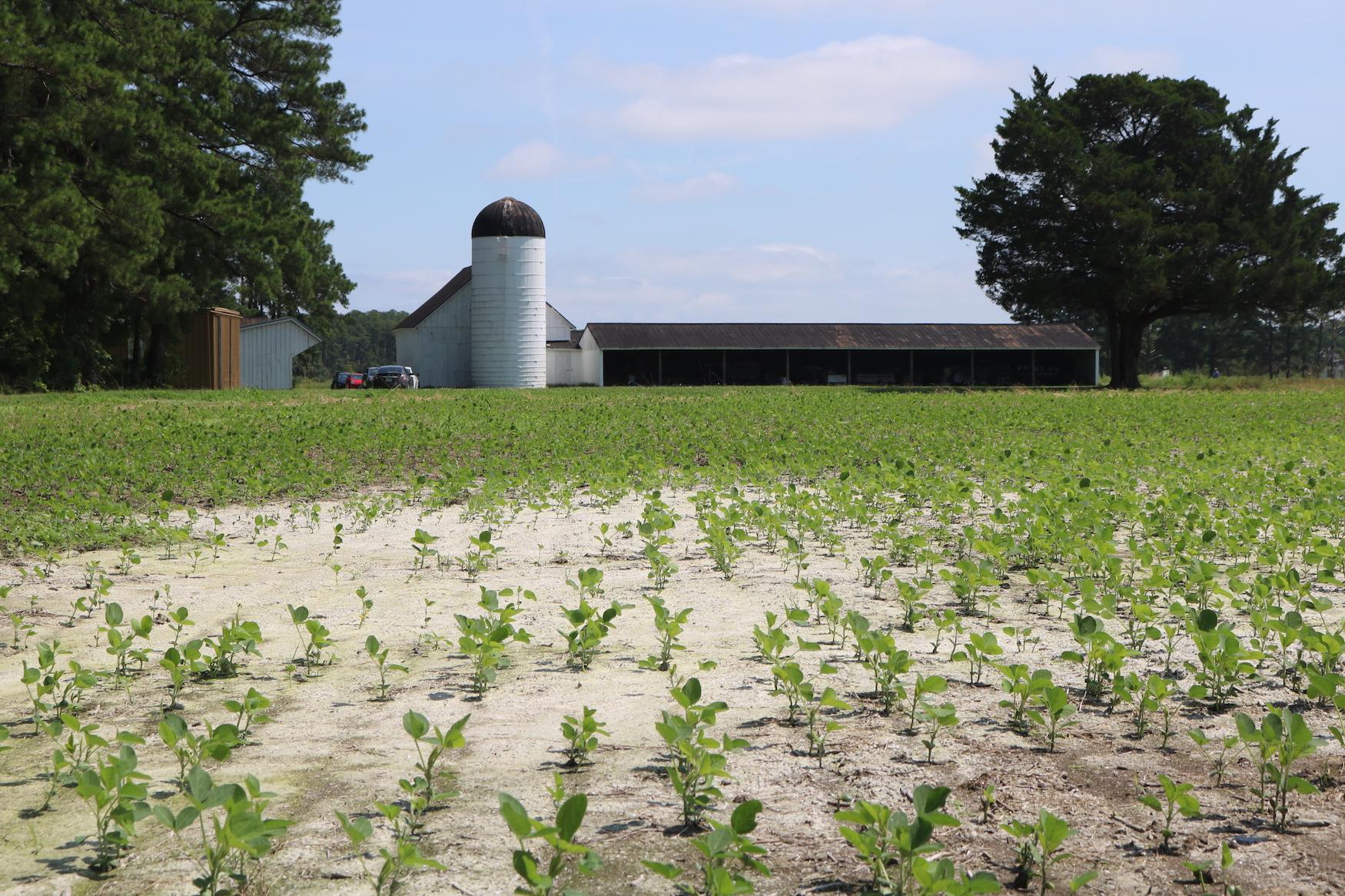
Very few crops yield substantial growth when salinity levels are consistently above two parts per thousand (ppt). However, many fields along the Eastern Shore with common cash crops planted — like corn and soybean — suffer from observed salinity levels equivalent to 3.8 ppt, causing severe crop damage (Tully et al., 2019),
Saltwater intrusion is like this invisible force creeping up on farmers, devastating their crops and leaving them searching for answers. So, who has these answers and what can be done to mitigate the damages?
Policymakers and nonprofit organizations at federal, state and local levels have made large efforts to address saltwater intrusion and alleviate its burden on coastal farming communities — including funding valuable research, implementing action plans, and providing assistance and options for farmers and landowners with salt-impacted soil.
Federal Government Programs
Several programs established by the federal government aim to preserve wetlands and other ecosystems through financial incentives.
One of the current programs in place for farmers to mitigate saltwater intrusion is the U.S. Department of Agriculture’s (USDA’s) Conservation Reserve Enhancement Program (CREP), which is an incentive program within USDA’s Conservation Reserve Program (CRP). In 1985, the CRP was established as part of the Farm Bill, and it helps landowners take their farmland out of agricultural production. The CREP is a program that facilitates specifically public-private partnerships, allowing states, Tribal governments, and nonprofit and private entities to partner with the Farm Service Agency of USDA to implement CRP practices that address high-priority conservation and environmental objectives.
Through the CREP, landowners receive payments for part of the costs associated with establishing the conservation measure and annual rental payments for the duration of the program. Conservation measures and environmental objectives for land in the CREP include but are not limited to restoring wildlife habitat, enhancing water quality, establishing wetlands, and increasing control of invasive species.
However, the measures implemented may not be permanent. After the original contract with CREP expires, landowners may choose to put that land back into agricultural production instead of renewing it for another 10 to 15 years with state approval. Even with that in mind, the CRP and CREP provide farmers with support in transitioning their farmlands out of production and into a more permanent conservation easement.
Similarly, the USDA’s Agricultural Conservation Easement Program (ACEP) is a program helping farmers to adapt their land to face pressures from saltwater intrusion better. Established under the 2014 farm bill, ACEP assists landowners in protecting, restoring and enhancing wetlands on their property. With ACEP, there are three different enrollment options: permanent easements, 30-year easements, and restoration cost-share agreements. Most landowners enrolled in the program have permanent easements, which protect a range of values from agricultural production to grassland protection for perpetuity.
Another federal program is the USDA’s Environmental Quality Incentives Program (EQIP), which provides financial and technical assistance to agricultural producers. The EQIP addresses natural resource concerns and provides environmental benefits, such as improving water quality, conserving ground- and surface water, increasing soil health, creating wildlife habitat, and mitigating against increasing weather volatility.
State Government Action
In 2018, the Maryland General Assembly required the Maryland Department of Planning (MDP) to draft a response to saltwater intrusion and its related impacts on the state. Maryland’s Plan to Adapt to Saltwater Intrusion and Salinization was released in December 2019 and identified significant areas of concern, research needs, and potential adaptation policies. The state interagency saltwater team meets a few times yearly to share information on progress and find more pathways to mitigating saltwater intrusion. One emphasis is the need for more extensive research that will inform adaptation and management approaches by providing lawmakers with an increased understanding of saltwater intrusion impacts in aquifers, surface waters, agricultural land, wetlands, coastal forests and infrastructure in Maryland.
Research Looking to the Future
The National Fish and Wildlife Foundation (NFWF), in partnership with the U.S. Environmental Protection Agency (EPA), granted the Harry R. Hughes Center for Agro-Ecology (Hughes Center) $469,888 to evaluate native perennial grass species for their ability to survive along the margins of salt-affected farm fields and for their ability to increase wetland habitat supporting native animal species like the American black duck. This is part of a project being conducted jointly with its partners at Dr. Pinki Mondal’s EASEL Lab at the University of Delaware (UD), Dr. Keryn Gedan’s Gedan Lab at George Washington University (GWU), and Dr. Kate Tully’s Agroecology Lab at the University of Maryland (UMD) also to map the reach of saltwater intrusion in Somerset and Dorchester counties and to complete predictive models that illustrate the future path and extent of saltwater intrusion across the Delmarva Peninsula.
“Our findings may help farmers and landowners expand their toolset of what they can do if they are facing (saltwater intrusion) on their lands,” said Dr. Kate Everts, Hughes Center executive director.
This research, along with previous studies, is crucial and serves as a tool on which policymakers can base their decisions, promoting science-based policies that target high-priority aspects of the issues.
Next Steps
Researchers expect the impacts of saltwater intrusion will continue to worsen over time. So, it is critical that federal, state and local governments and lawmakers continue to respond to saltwater intrusion now and in the coming years. This complex issue poses many challenges to residents and landowners along coastal areas like the Eastern Shore of Maryland. Farmers and landowners need more guidance on adapting to their changing environment, implementing strategies to alleviate the burden of saltwater intrusion, and finding other environmentally and economically viable options for salt-affected farmlands. Collaboration between all levels of government, scientists, nonprofits and other stakeholders is vital.
Resources
- USDA’s Conservation Reserve Enhancement Program (CREP) Fact Sheet: https://www.fsa.usda.gov/Assets/USDA-FSA-Public/usdafiles/Conservation/PDF/fsa_crep_factsheet_22.pdf
- USDA’s Agricultural Conservation Easement Program (ACEP) Fact Sheet: https://www.nrcs.usda.gov/wps/PA_NRCSConsumption/download?cid=nrcseprd1840826&ext=pdf
- USDA’s Environmental Quality Incentives Program (EQIP) Fact Sheet: https://www.nrcs.usda.gov/Internet/FSE_MEDIA/nrcseprd1919229.pdf
- MDP’s Maryland’s Plan to Adapt to Saltwater Intrusion and Salinization: https://planning.maryland.gov/Documents/OurWork/envr-planning/2019-1212-Marylands-plan-to-adapt-to-saltwater-intrusion-and-salinization.pdf
The landward movement of seawater into coastal communities is causing salt damage to land along the eastern seaboard of the United States. For coastal communities like on Maryland's rural Lower Eastern Shore, that can mean invasive marsh species, undrinkable water, damaged forests, reduced agricultural crop yields, and salt-stressed soils.